

Stulabhal [Stulaval]
Good walks are even better shared.
NB1312 : Summit plateau on Stulabhal with view towards An Cliseam & Mulla bho Thuath
Colin Park Photo source
Overview
Overview of Stulabhal [Stulaval]
Stulabhal, affectionately known as Stulaval by locals, stands proudly at an elevation of 622 meters in the stunning Scottish Highlands. It's classified as a Marilyn, a term used for hills with a prominence of at least 150 meters, making it a worthwhile challenge for outdoor enthusiasts.
Geology
The mountain is composed of ancient gneiss, a type of metamorphic rock formed under immense pressure and heat. Stulabhal's rocky terrain provides a glimpse into the Earth's geological history, shaped significantly by glacial activity during the last Ice Age. As you ascend, keep your eyes peeled for interesting rock formations and unique striations that speak to the mountain's dramatic past.
Routes
The Stulabhal Circuit is the popular route chosen by many hikers. This challenging circuit promises a rewarding experience with not just physical exercise but also spectacular views. The journey covers approximately 10 km and typically takes about 4 hours to complete.
Summit Features
Upon reaching the summit, hikers are greeted by a well-built cairn, which serves as a beacon for weary climbers in need of a breather. It also doubles as an excellent backdrop for those all-important Instagram photos.
Terrain
Expect a mix of rocky paths and heather-lined trails, with patches of boggy ground that will test your balance—so bring your best rain boots! It’s advisable to tread carefully, especially after a shower, as the Scottish weather has a penchant for transforming paths into slippery slopes.
Views
The summit treats hikers to breathtaking panoramic views of the surrounding Highlands, including the shimmering lochs and undulating valleys that are a hallmark of this part of Scotland. The best time to enjoy these views is late spring through early autumn when the weather is generally more forgiving, and the landscape bursts with colour.
Hazards
As with any mountain adventure, Stulabhal isn't without its hazards. Be prepared for rapid weather changes and the possibility of low visibility in cloud cover. The rocky terrain can also become treacherous when wet, so wise footwear is your best friend.
Nearby Summits
For those hungry for more, nearby peaks such as Carn Dredon (642 meters) and Beinn Tarsiing (635 meters) beckon, providing additional opportunities for exploration and adventure.
Access
Accessing Stulabhal is relatively straightforward, with parking available at a lay-by on the A855, about 5 km from the trailhead. Public transport options are limited, so a car is the preferred mode of travel, with Portree being the nearest town offering necessary amenities and services.
Facilities
While you won't find facilities right on the mountain, Portree provides a selection of cafes and shops where you can fuel up before or after your hike, along with public toilets for when nature calls.
History
In addition to its impressive nature, Stulabhal carries a rich etymological significance, with its name translating to 'hill of the proud' in Gaelic. This mountain has played a role in local folklore, featuring in ancient tales that contribute to the cultural tapestry of the area.
In closing, whether you are seeking a challenging hike or simply a stunning view of Scotland's wild beauty, Stulabhal should certainly be on your bucket list. Just remember to pack plenty of snacks—you’ll need the energy!
Explore routes near Stulabhal [Stulaval]
Walks starting near this hill. Open a route to check its map, distance and full itinerary.
Beautiful private beach walk Isle of Harris
View route
Berneray Community Hall to the beautiful beach
View route
Fairy Lochs Liberator Wreckage Circuit
View route
Route planning notes
These notes describe possible approaches. Check a route's map and access information when planning your walk.
The Stulabhal Circuit
A scenic circuit that starts from the nearest village, offering breathtaking views and a challenging ascent, perfect for experienced hikers.
Make a day of it, together
Find someone to share the walk with, or organise a day out along a route you like.
Photo Gallery
View all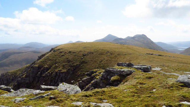 Photo could not load
NB1312 : Summit plateau on Stulabhal with view towards An Cliseam & Mulla bho Thuath
Colin Park
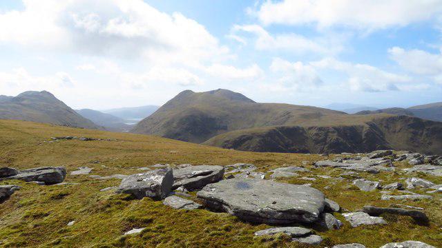 Photo could not load
NB1312 : Summit plateau on Stulabhal with view towards Teileasbhal
Colin Park
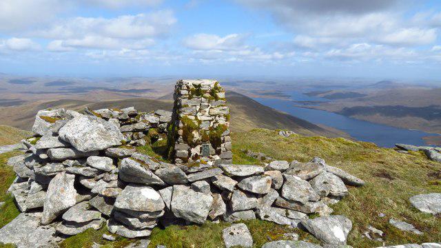 Photo could not load
NB1312 : Summit trig point on Stulabhal with view towards Loch Langabhat
Colin Park
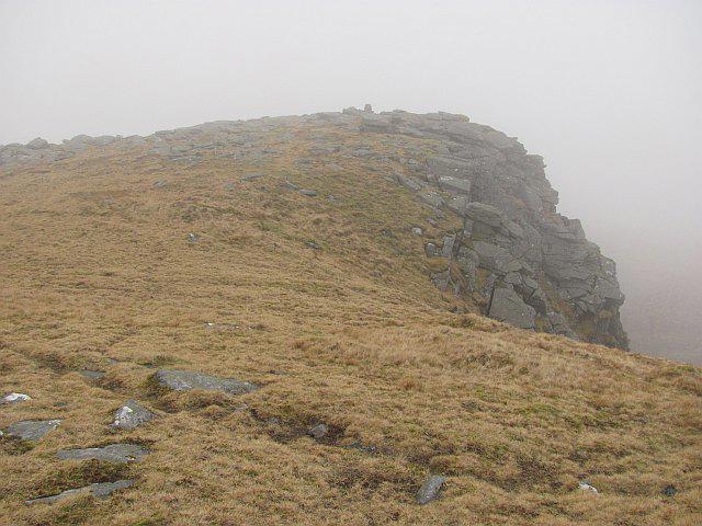 Photo could not load
NB1312 : Summit, Stulabhal
Richard Webb
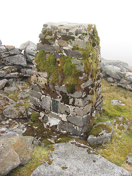 Photo could not load
NB1312 : Triangulation pillar, Stulabhal
Richard Webb
Hill facts and local notes
Classifications
Elevation
579m
1,900 ft
Prominence
225m
Coordinates
58.0065, -6.8547
NB133122
OS Map
13 14
Explorer: 456
At the Summit
The summit features a notable cairn that provides a perfect spot for a rest and a photo op with the surrounding landscape.
Terrain & Geology
Stulabhal is composed of metamorphic rock, predominantly gneiss, which gives the mountain its rugged appearance. The geological history reflects significant glaciation, with evidence of striations and horn-like features formed by ancient ice.
Views & Scenery
From the summit, hikers can enjoy panoramic views of the rugged landscape of the Scottish Highlands, including nearby lochs and valleys.
History & Heritage
Name Origin
The name 'Stulabhal' derives from the Gaelic 'Stulavhal', meaning 'hill of the proud'.
Historical Significance
The mountain is a renowned landmark in local mythology and history, often featured in ancient tales of the Highlands.
Getting There & Facilities
Parking
Parking available at the small lay-by on the A855, approximately 5 km from the start of the hike.
Public Transport
Limited public transport available; best accessed by car. Local bus services may operate from nearby villages.
Nearby Facilities
Facilities in Portree include cafes, shops, and public toilets. There are no facilities directly on the mountain.
Safety Information
Known Hazards
- Potential for rapid weather changes; low visibility in clouds; boggy ground in wet conditions.
General Safety Tips
- Check weather conditions before setting out
- Carry appropriate clothing and equipment
- Let someone know your planned route
- Take a map, compass, and GPS device
- Carry emergency supplies: food, water, first aid kit, torch
Hills
Some common questions about the hills answered
Are there group walks up Stulabhal [Stulaval]?
Many walkers use Walkmates to join or organise walks with others. You can check for group walks around Stulabhal [Stulaval] through the maps
Are there other walkers around Stulabhal [Stulaval]?
Activity varies by location and time, but Walkmates lets you see whether others have shared walks or shown interest in this area. Find other people through the walking friends search walking friends for Stulabhal [Stulaval] search or of course create your own walk for Stulabhal [Stulaval]
Can I organise a walk to Stulabhal [Stulaval]?
Yes. If there aren’t any walks listed already, you can create a walk and make it available for others to join.
If you're signed up to Walkmates, you can create a walk to Stulabhal [Stulaval].
How do I find a walk up this hill?
There are often multiple ways to walk this hill, depending on experience and route preference. Walkmates helps you explore walks and routes that others have shared.
Can I suggest a new route up Stulabhal [Stulaval]?
Yes. You can suggest or create routes to share with others. Walkmates focuses on the social side of walking, so routes are used to help people organise walks and explore areas together, rather than as detailed navigation tools or route libraries.
Other uses really appreciate knowledgeable walkers sharing their routes. Share your favourite route to Stulabhal [Stulaval] here
The is an error or something incorrect about this hill. How do I let you know?
We always strive to keep the information on Walkmates as accurate as possible. If you find an error, please let us know through the contact form and we'll aim to correct it as quickly as possible
Community Discussion
Comments
Location
![Stulabhal [Stulaval] location map](https://cdn.walkmates.com/hill-maps/hill-sources/1591/58.00648_-6.85466.png)
Grid reference: NB133122
View on OpenStreetMapOpens a map in a new tab, centred on the hill.
No comments yet. Be the first.